How to manage delivery during COVID 19 pandemic due to which many routes would have been blocked as they are hotspots?
As the drivers rush to complete the delivery of assets and food, they must have information available with them about the hotspot routes and the alternate roads to reach the destination to complete the delivery safely.
Problem:
From the above few lines, we understand the challenges the delivery executives face while completing the delivery. As they start towards the destination, they need to have a clear route that avoids the hotspot areas and roads.
This problem needs the help of technology to guide the delivery executive with the safest and shortest route.
Through the application used by the delivery executives, the IT Team displays the best route to the destination on the handheld devices.
The roads are blocked and unblocked by the government authorities after some days as the situation changes. The driver or delivery executive must be made aware of these changes.
Solution:
With the country getting into lockdown state to restrict the spread of COVID 19 the cities witnessed blocked roads and streets to keep a check on the movement of the people.
There were limited roads and lanes open to ensure the delivery of essential items including food items, medicines, and other essential packages.
This gave rise to the demand for a navigation system which can provide a safe route to the destination while avoiding the COVID 19 hotspots.
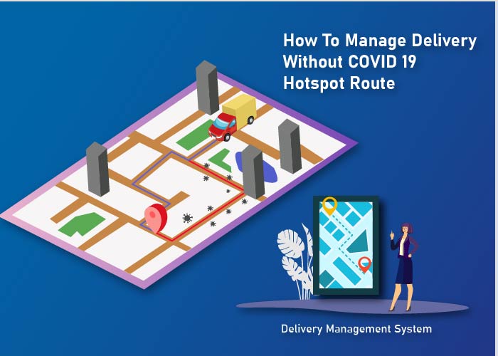
The delivery executives get the different routes that are not blocked due to being in hotspots or containment zones displayed on their screen which helps them avoid such routes and reach the destination safely.
This facility is enabled by mapping the roads using satellites or via drones and feed the information about blocked roads or roads with barricades to the master database.
When the delivery executives enter the destination to the handheld devices, the master database provides the input about which roads to avoid and where to turn.
The images provided by satellites or drones are of high resolution which helps in marking the roads, turns, and diversions. This helps the delivery executive get clear guidance while they are on their way to the destination.
As the roads are blocked and the city is under lockdown, it is tricky to understand if a road has no traffic or less traffic. This could lead to confusion for the delivery executive.
Hence the delivery fleet and the fleet manager need to have the information about the possible routes before they start. The data from the mobile phones or other GPS devices of vehicles that are already moving on the roads provide this input to the master server which in turn is transmitted to the delivery companies.
The online GPS tracker could guide the driver and the fleet manager about the roads, lanes, flyovers, under construction roads, blocked roads, and blind spots.
Even at the places where there is no mobile signal, the GPS will continue to guide the rider until they reach the area within the network coverage. Once in the network coverage area, the map gets updated with the details which were lagged out.
As the roads get unblocked and new roads get blocked the movement of vehicles gets captured by the GPS and is fed to other application users. This takes care of the distribution of updated route data.
A dashboard is prepared in the software on the handheld device which displays the hotspots and suggests an alternate route to the delivery fleet and the fleet manager.
The customer is also informed if the destination falls inside the hotspot or containment zone.
The data is provided by the government authorities to the logistics companies as and when it is available.
Obstacle:
If the destination is inside the hotspot area or containment zone, it is also a challenge for the delivery executive to reach the destination if the delivery address falls inside the hotspot.
This will hamper the last mile delivery process and will lead to customer dissatisfaction as the package could contain critical medicines or other medical equipment.
Work Around:
To overcome this, the delivery executive could contact the recipient and ask them to reach the border where they could collect the package.
Once the customer reaches the border of the hotspot area, the delivery executive could make a contactless delivery from a safe distance.
BIRD’S EYE VIEW
This term is used to describe the view as seen from drone camera and helps in marking the routes, passages for 2 wheelers or e-cycles, closed roads, etc.
This facility is used by city authorities along with logistics company and is accomplished by using unmanned and remotely operated drones to identify the blocked roads which get marked in the master database.
These marked roads are then removed by the software while calculating the best possible routes to the delivery executives.
Many companies provide the drone service to the government authority or private companies in the logistics business and thus help in mapping the best possible routes.
Without the use of aerial maps, all the planning would have been done by sketching routes on physical maps which makes the routing complex and confusing.
FUTURE TECHNOLOGY
Drones that are being used to monitor hotspot area and containment zones are also being tested for lightweight package delivery mainly containing food and medicines.
Few companies are testing the drone to deliver food as of now and are trying to keep the human involvement to as low as possible.
Conclusion
While the COVID 19 throws challenges, several companies provide solutions using IT.
With the help of drones and GPS from mobile devices, the changes in the hotspot areas and containment zones are gathered and provided to the logistics companies.
With advanced technology, all information exchange activity about open roads, hotspots, and containment zones happens in a matter of minutes.
Would you like to know more
Would you be interested to manage & track your deliveries with delivery management system?


